Reason To Go On A Bike Tour: The World Is Not The Map

Going a long distance on two wheels is a relatively recent human pursuit. Especially doing it for fun. Aside from the two most important modern creations that make this possible – the bicycle, and the road itself – there is another thing we have come to depend on, to make the adventuring safe and successful: An accurate, portable map.

We rely on the map to get from one meal and bed to another, with a minimum of backtracking and unpleasant surprises, in environments where those things are rare, or where the signs for them are obscure. It becomes more important the farther we wander from home. We have developed a certain level of trust in the map, and therefore in the people who constructed it: We expect them to tell the ground truth, with no artistic embellishment.

In the middle of long, winding roads through mountain passes, with many forks branching ahead of us, and daylight waning, and just a few hospitable dwellings marked out, our very lives can depend on the accuracy of a map. Guiding us safely and accurately in those situations – and all others – is what the modern map is for.

This was not always the case!

World map assembled by Andrea Bianco in 1436
World map assembled by Andrea Bianco in 1436

Here There Be

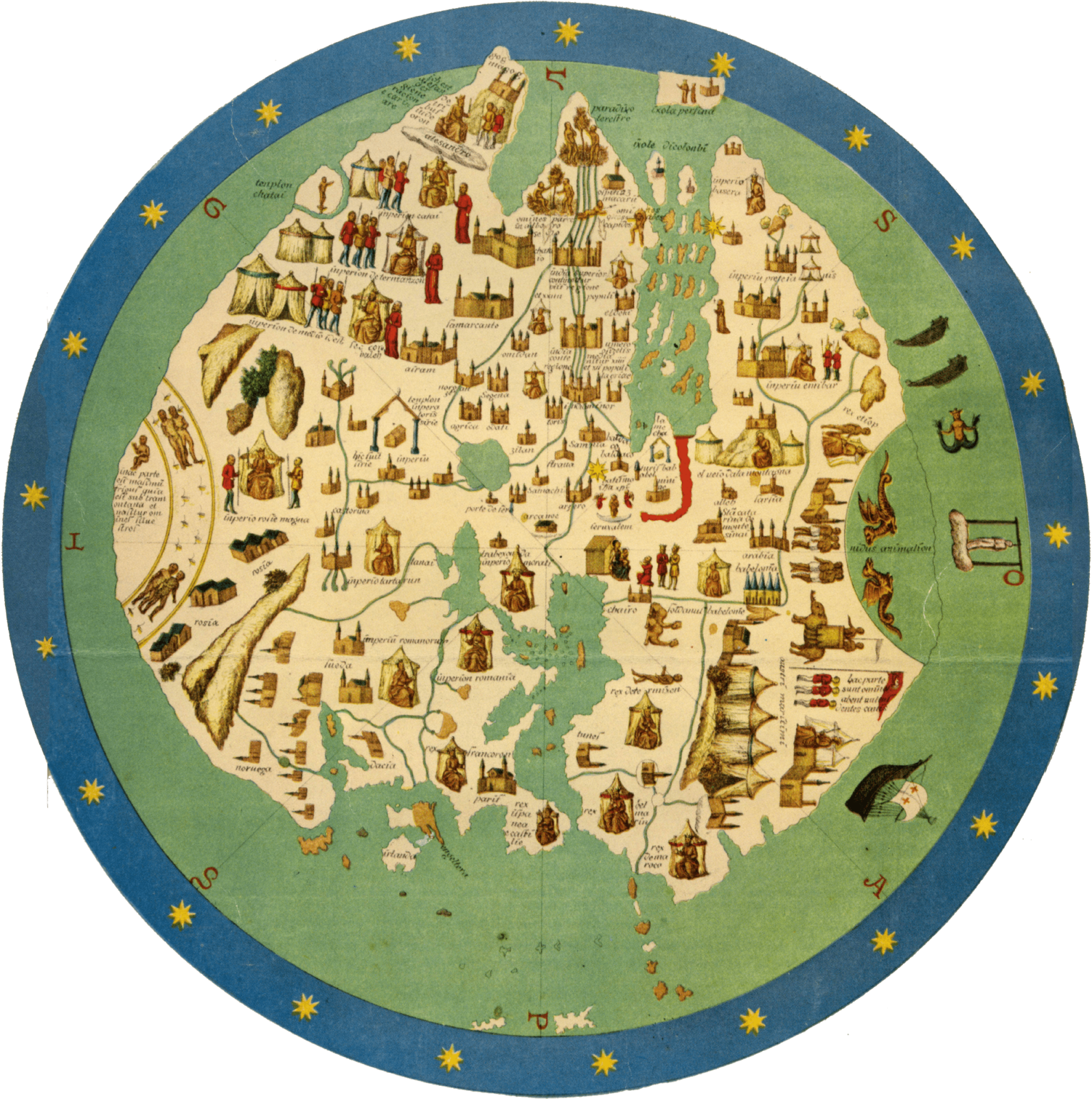
In Europe back in the 15th century, maps of the world were not used for navigation, but as propaganda and entertainment.  Large-scale maps were weirdly inaccurate and chock full of exotic labels and figures to stir the imagination — and sell more copies to the curious middle class.

A dabbling dilettante might purchase a map just to pass it around at a social gathering, and inspire their friends to trade rumors and tell outrageous stories:

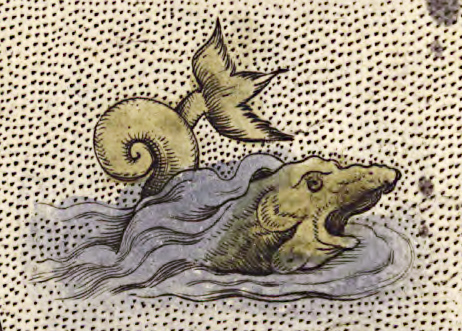
“Hey, look at this island here – Ewaipanoma.  There are weird headless people on it.  Instead of a head they have eyes bulging directly out of their chest, and a giant mouth in their stomach.  Here’s a drawing; it must be real!”

“And look at this chunk of ocean.  It’s labeled The Red Sea, and wow, it’s blood red!  I wonder what it’s like to sail across that.  Does it stink?  Are there Mer-men in it?  (Excuse me; could you pass the snuff?)”

Detail of Martin Behaim's Globe from 1492, in a facsimile produced in 1908 by the geographer Ernst Georg Ravenstein
Detail of Martin Behaim’s Globe from 1492, in a facsimile produced in 1908 by the geographer Ernst Georg Ravenstein

Map makers of the 15th century were taking liberties with the irregular facts at hand to tell a good story, and sell a few more maps. These creations were works of art as well as reference, and so they embodied both knowledge and attitude, and to our modern eyes it’s also clear that by exaggerating the freakiness of the non-European world they stoked the common racism and religious bigotry of the time. Given that the average person was never going to travel outside their home country, how would they know any better?

If the map maker Andrea Bianco mislabeled an entire continent and made the inhabitants out as monsters, no one could call him on it. Maybe they were all just godless aliens out there, and we should put a pre-emptive boot on them, for our own peace of mind… (And so, 400+ years of colonialism.)

Iceland, depicted in the Carta Marina from 1539, enhanced with color. The ice floe has long since melted.

This kind of distortion is not just in relics from the past.  It can appear in any art that depicts a far-away place, including very modern media. The line between entertainingly fanciful, and offensively alien, tends to drift as well.

Europe as represented on a Japanese map from 1932. That’s Hitler tussling with then-president of the Weimar Republic Hindenburg in Germany.

Consider our modern obsession with space travel:  We have made a few tentative steps into the solar system, but the facts have been eclipsed in popular culture by Star Wars, Avatar, Star Trek, et cetera.  15th century maps had their “headless men”, and we have our “alien xenomorph.” If we landed a spaceship on some cold moon of Jupiter and found it was teeming with creatures that looked and sounded just like the “xenomorph”, how many of us would freak out and want to kill them all immediately, despite their scientific importance?  Despite the fact that for all of human history up to that point they’d left us alone?

Believing in a universe full of hostile aliens can sound like common sense in any era:  You’ll never be caught with your guard down.  But like most common sense, there’s a blind spot, in this case big enough to fit the whole of the colonial era inside:  Keep your xenophobic guard up and you might be an unwitting sponsor of atrocities against perfectly ordinary people. The more truth – or perhaps just dignity – we gather into our representations of the world beyond, the less likely we are to start a war.

If only you understood them, you could avoid disaster… (Alien Legacy, 1994)

And so, better maps make better neighbors. Instead of believing the world is full of savages that need colonizing, we learn that the world is full of people, and the colonialism is the savagery. Xenophobia inspired by artistic license slowly loses ground to the need for navigational accuracy.

The Shrinking Stage

In 1570, when William Shakespeare was 6 years old, the first book of maps was published.  Reflecting the culture of the time, this book – effectively the first ever world atlas – was titled “The Theater Of The Lands Of The World.”  It aimed for something more serious than middle-class entertainment:  A truly accurate geographical representation, suitable for outlining an actual ocean voyage.  The world remained a theater but now it was one that real people might act upon.

The Greek peninsula, according to the Orbus Terrarum

Ten years after that first edition (the first of many) was published, Sir Francis Drake returned from sailing around the globe – the first Englishman to do so – with a hoard of gold, silver, and spices he’d plundered along the way.  The treasure was so great (and he’d been gone for so long) that after he dropped anchor in Plymouth Harbor, he had to wait quietly on his ship until midnight, and then send a small anonymous party ashore to find out if Queen Elizabeth was still in power and could still provide protection while he unloaded his riches.  The success of the journey was a huge surprise, and fanned the flames of the public obsession with the uncharted world past the horizon.  The world was full of mystery and monsters, and it was also full of treasure, and real men had sailed out upon it and brought some back.  Perhaps anyone could.

An Orbus Terrarum sea monster

Twenty years after that, when Shakespeare’s company was popular enough to commission its own theatre space, what better name to seize the imagination than  “The Globe”?

The globe theatre, as depicted in an engraving by I. Hondius in 1610

As maps became more accurate, the globe became more accessible, and less terrifying.  In our modern age we’ve taken this about as far as it can go:  The entire Earth is a pale blue dot on the screen of a smartphone, easily covered with the palm of one hand — yet anyone can use their fingers to zoom the image continuously down to the individual trees on the street outside their house. If we can see the people on the opposite side of the planet just like the people living on our own street, we are less inclined to demonize them and more inclined to collaborate, and a vision of the human race as a single tribe spanning the globe is within reach. That is a fantastic development.

At the same time, this increase in accuracy has increased our tendency to substitute one scale for another. It becomes very easy to believe that all movement is the same regardless of scale, and that all places in the world are equally well known — because they’re all on one map, and everyone uses the same map, aside from some tiresome arguments over border lines and labeling. Through that we developed an unwarranted sense of familiarity.

Human brains evolved to keep track of about 100 personal relationships and a few square miles of land in detail at most, and brains haven’t changed in the face of this new technology.  To conceive of the entire planet as one place, we have to skip over a literally inconceivable amount of detail.  We reduce huge chunks of territory and uncountable numbers of people down to a photo, a paragraph, or an icon beneath a finger, and let the rest blur into mush.

Affordable, decentralized communication has made the whole world more familiar, but it has also made the world seem smaller and much more consistent than it really is.    

How Americans view Europe (courtesy of Ducktales)

Play’s The Thing

I can flick the screen of my smartphone, scrolling from my home town over to the Great Pyramid of Giza and “see” all the terrain between, thanks to satellite mapping.  I can board a plane, spend 17 hours napping uncomfortably, pop out next to the pyramids, walk all around them, and then fly back home, all in a few days.  I was here; then I was there; then I was here again.  The dot on the map tells me so.

Everything I skipped over is just a gradient between the familiar experience of home, and the foreign experience of the pyramids, and since there are no big fancy icons on the map in between, I haven’t missed anything important, right?  I can look out the window of the plane and see the terrain scroll by just like on my smartphone.  Looks about the same.

This is what travel is for us now. Even when we would rather move slowly and see the land between, we are thwarted by the need to get back to our job and other obligations — and so we rely on the dot and the map to tell us that yes, we have really gone somewhere.  

Everything looks so flat from up here...

We instinctively know that we’re missing something.  We instinctively know that when Shakespeare wrote “the world is a stage,” he was getting to something important.  In airplanes and trains and cars, we can skip around the globe like stones across a pond, but traveling that way is the equivalent of sitting down for Act 1 of Hamlet, hearing a few of the opening lines, and then suddenly it’s Act 5 scene 2 and everyone is scattered around dead, and Horatio is all, “What is it ye would see?  If aught of woe or wonder, cease your search.”

We know some important changes have happened.  We can see the evidence all around.  Based on what we see, we can assemble the story of Hamlet like so:  A bunch of people were alive, then they fought and almost all of them died.  That summary would not be wrong. But of course, there is so much more.  It’s all there, in the terrain we skipped; the scenes we didn’t watch…

The Unbroken Line

What if you could leverage the modern map to travel safely and accurately, but also experience a story that plays out across this world stage, with no interruptions?  What if you could move through the scenes and have the time to notice all the details that haven’t been granted a symbol on the global map?

What if you could establish a truth inside you as a counterpoint to the gridwork of flight-lines that link monuments and urban centers:  The entire world as a continuous place, every corner of it real, every person on it part of the play? What is it like, to be in those in-between places long enough to know them as their own?  To breathe that unbroken channel of air that is split aside by the plane, or the train, or the windshield of the car?

With a bicycle, you can find out.

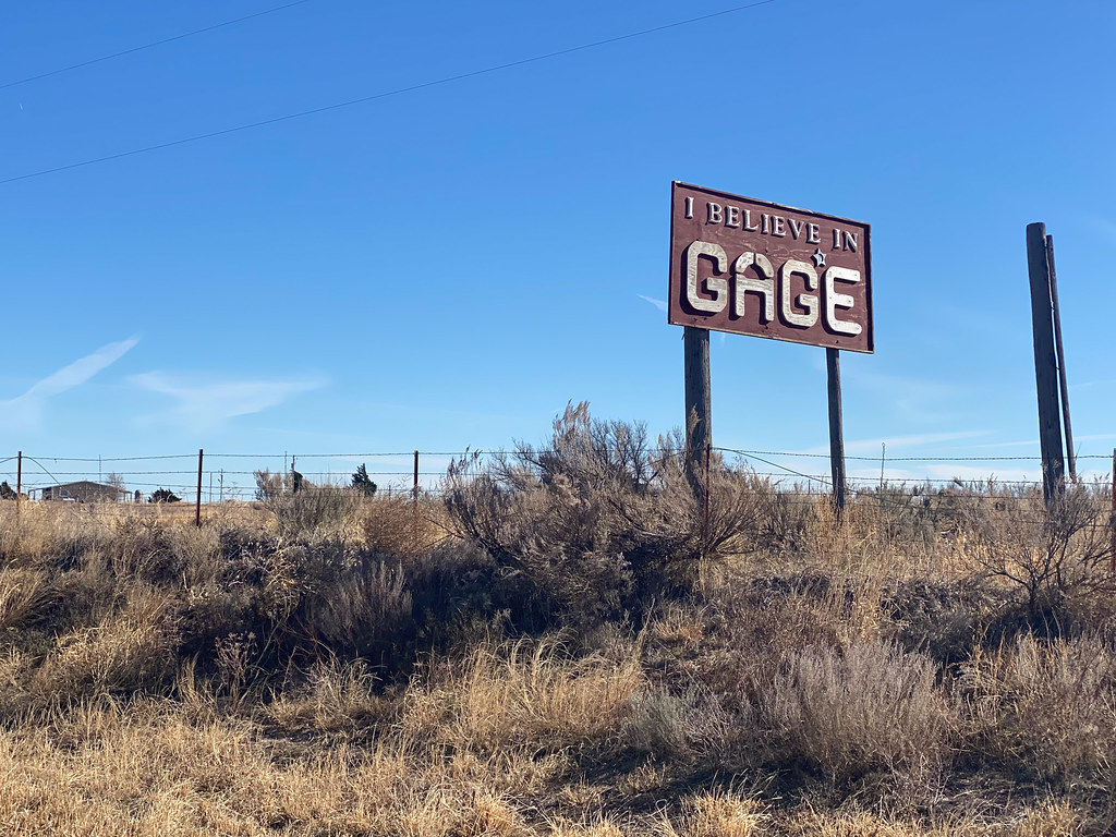
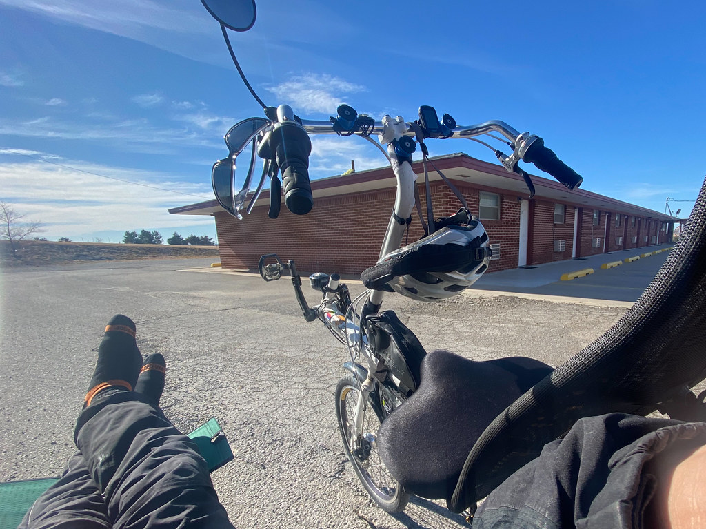
It's not very direct, but it sure is pretty

The maps available in this modern age are exquisitely, astonishingly accurate, and are no longer full of headless men and blood-red oceans, and can be mined for information in ways that were unknown just half a generation ago — or even just a few years ago.  With a smartphone in your hand, you can see your exact spot on the globe, inspect the terrain ahead, find a place to stay, find food and water, book transportation, locate supplies… And beyond the map, you can see weather predictions, manage your finances, contact emergency services, practice speaking and reading a language, and call up someone you know to ask for guidance. And the device you do this with fits perfectly on the handlebars of a bike, and the battery lasts all day!

Our modern maps can guide you safely, because they are no longer infested with artistic embellishments like “here there be dragons”. But nevertheless, the regions they cover are full of adventure and surprise, as they always have been. From the seat of a bicycle, you can discover it. The possibilities for lightweight, independent, flexible travel are far, far greater than they’ve ever been in history.

All you need is the inspiration to think outside of the literal box: Why buy a tour package to some big-name destination, and sit on your ass in a series of metal boxes that haul your body across the space between, rendering it intangible and irrelevant, when you could have a continuous sensory experience, breathing the air, hearing the wildlife, seeing the terrain unmediated, feeling the rain and wind and sunlight, knowing the change of the land with your own muscles?

You can do it! Go on a bike tour!

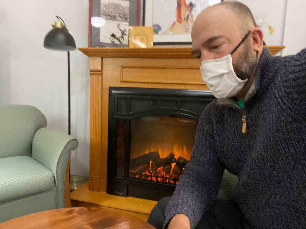
Enjoying the windy road.

Fine weather to Woodward

Ready for one more day of riding together!

The shapes and colors and textures of the grassland are enthralling.
Joyous late fall colors.

Growing quite a beard...

The closer you look, the more diversity you find, in plant and insect life.
Every time you roll onto the grass, you take a risk. There are incredibly sharp burrs scattered within, and a heavy bike will punch them right through regular tires.
Plenty of hay for the snacking.

Margaret calls this animal a "Tire-rim-asaurus Wrecks!"

Hisssssss!

Assembled 27 years ago and holding up well, apparently.

Thanks, Jim, for the roadside amusement.

I'm glad someone does. The town could use some help.

I wish I had time to visit every one of these cemeteries and lounge in the sunlight.

Curious critters.
Tagged for reference!
Cows in the sun.
Chomp chomp chomp chomp
A fox darting across the road. A truck slowed down for it.
If you try to attach a plow to me, I'll kick your face in!
They're coming up to greet me, in quite a hurry. They'll be disappointed: I have no snacks!
Critters outstanding in their field.
Just in case you're not already aware of the critters here.

I have never encountered a sign quite like this, anywhere else in the world.

Welcome to the tree ranch!
A gas refinery, I believe.
Only a few more miles to go today!
Five miles of no shoulder. Thanks, Oklahoma.
Pick a direction: More flat!

I don't know who set this up, but... Well played, my country friend.

So that's where all the boomers are!

You knows it!

Parked after a long but interesting day of riding.

All moved in!

Wrapping up in Shattuck

I would have really liked to find the old family farmland and walk around on it — or at least known which parcel of land the farm used to be on, even if there was a warehouse or an industrial crop circle built over it now. But with only a few photos from 1981, the name “Pony Creek”, and an old topographical map, I couldn’t solve the mystery.

An old topographical map showing Pony Creek near Shattuck

My conversations with locals didn’t scare up any new information. My father and I poked gamely around in satellite view, trying to reconstruct the route he remembered driving out of Shattuck to get there, but he’d made the journey only once, 40 years ago. Nick and I would have to be satisfied with a general impression of the area.

This country has many layers.

And an amazing impression it was. The late autumn colors and the layered flatness of the terrain were very unlike our California home, and the wide open sky above that terrain seemed to command our attention in a way that the skies back home rarely did. Everything up there was bigger: Massive clouds, sprawling sunsets, driving winds, fat raindrops. And we were at the mercy of that sky. Whatever it brought, fair or foul – or maybe even apocalyptic – there was no place to hide from it.

Birds on the move.

In fact, even with headwinds punishing us for several days of the trip, we’d been pretty fortunate. We could have had to pedal through lashing rain, or hide indoors while lightning blasted around us and the highways flooded. The one time the wind really picked up to something nasty and was hurling debris, we happened to be riding in exactly the same direction and were swept along, more than doubling our speed for the entire day.

All we had in Shattuck was a little wind and a sprinkle of rain, and otherwise the days were clear and crisp. I even got to work outdoors!

Usually I wear a much bigger hat for working outdoors!

Lounging in the sun, in the otherwise empty motel parking lot, getting some work done.

Our plan was to spend a final day here, then cycle east to Woodward and hunker down for a few days until a U-Haul truck became available. Then we would throw in the bikes and zip down to Fort Worth, poke around there for a day, and then the trip would be officially over with the loading of Nick on the train back to Los Angeles. Originally I thought we would be able to get to Fort Worth entirely by pedaling, but work hours and extra rest days compelled a change. We got to Shattuck; that was the main thing!

One more day of crossing this amazing terrain by bike. Time to make the most of it.

The Birkle Family – Germans From Russia

This is the story told to my father, Ben Birkel Jr., by Birkle uncles and cousins at the family reunion he attended in the summer of 1981 in Oklahoma; plus excerpts from “A Pioneer History of Shattuck” published in 1970; plus anecdotes from his mother and his own recollections.

Daniel Birkle, my great grandfather, was born in Dreispitz (Дрейшпиц) Russia, a settlement near the Volga river, on November 6, 1865. His parents were originally German, but had moved to Russia some time after 1763. They were part of a group of German families that moved there collectively, having been promised by Catherine The Great that they would be given land to cultivate, reduced taxes, religious freedom, and exemption from military service, as long as they farmed and maintained the land according to their relatively modern standards, and protected it from the nomadic Muslim tribesmen that would occasionally invade from the south.

When he was still a child, Daniel’s parents died of cholera and Daniel was raised by foster parents by the name of Gloss. By the late 1800’s most of Catherine The Great’s original promises to the German settlers had been nullified by subsequent Russian leaders, including the freedom from conscription, and as soon as he was an adult Daniel was ordered to serve in the Russian army. After several years he was discharged a lieutenant.

Fraternizing with non-German Russians was strictly forbidden, and Daniel returned directly to the German settlement. There he met Mary Dorothy Olenburger, and they married in 1890. (She was a Russian German also, born in Dreispitz on Christmas Day in 1873.) When they married, Daniel was about 24 and she was about 16. Not a particularly remarkable age difference in those times.

Their first child died at birth, but then they had a daughter Marie, and a son, Daniel Jr., followed three years later by another son, John. Cholera was still stalking through the settlements, and Daniel knew he would soon be re-conscripted into the Russian army and probably not survive. Mistreatment of the German settlers at the hands of the Russian government was growing ever worse, and after much deliberation, the family sought and found a way to come to America. They bundled up John (age 1), Daniel Jr. (age 4), and Marie (age 5), and Daniel and Mary (who was expecting another child at the time) joined the large exodus of German people who had vivid hopes of escaping to a better world.

Stealth was necessary because the Russian government did not want their productive German settlers escaping their grasp. First the emigrants had to leave the Volga river area and make their way overland nearly 1000 miles to St. Petersburg, where they could merge with larger groups of fleeing refugees to obscure their movements. The journey was not an easy one. Most members of this group traveled by foot and ox-drawn wagon, and at night whenever possible. Their vehicles deteriorated and finally broke down. The oxen eventually died. They continued on foot. Those that survived eventually crossed from Russia into East Prussia, where they found aid on their journey from a German underground organization.

(This would eventually prove to be a one-way journey: In 1918, during the Russian Civil War, the original village of Dreispitz was plundered for the last time, and burned down. Later – after World War II – Stalin declared the entire idea of Russian Germans a heresy and systematically broke up their families, shipping the men off to work camps and seizing their land.)

At Hamburg, Germany, Daniel and his family caught passage and traveled on the Pretoria. During the three week voyage on the Atlantic, Mary gave birth to their daughter, Olanda (Lillie). They docked in New York in 1898, but took a long time to get through immigration at Ellis Island since they could speak no English.

Eventually, the Birkle family moved west, and settled near Avard, Oklahoma, on rented land. While subsisting there, a fifth child Joe was born. Shortly thereafter they moved north of Waynoka and Ben Sr. (my grandfather) was born, in 1903. Daniel and his family completed naturalization and, in 1904, they crossed the Cimarron River and moved to Ellis County, settling four miles northwest of Shattuck on land granted to them by the government.

Their arrival on the Western plains may have felt familiar, if they knew the stories of what their own ancestors had been through when they first arrived at the Volga river: The land was utterly undeveloped. Long months or even years of back-breaking work would need to be done, clearing it, breaking the soil, and sowing the crops by hand. Only after several successful harvests would they even be able to consider constructing an actual house. They were very fortunate, for their land featured a flowing spring surrounded by big cottonwood trees (since gone).

At first, the family lived right next to the spring, in a dugout – essentially a hollowed out section of hillside with rudimentary reinforcement, a bit like a sod house – and worked the farm while building a permanent house nearby. This took years, but eventually they acquired a team of horses to help them, plus a bull and one cow. Homestead laws in Oklahoma prohibited residents from grouping together into villages — they were required to live on the land they claimed. With many hands to work in parallel, larger families found an advantage.

How the ravine looked to Ben when he visited the farm in 1981.

A more distant shot of the ravine as Ben saw it in 1981.

A view of the spring itself where the dugout was located.

They built the house on a hill near the spring. It was made of rock and mud, with 18-inch thick walls and two rooms. When Ben Jr. (my father) was there in 1981 he took pictures of the remaining wall pieces and found some tools along with (what he assumed to be) clay marbles.

Some of the rock wall remains. Shattuck, Oklahoma is visible in the background.

The window and door frames were made of split logs and the frame for the roof was made of rough two-by-fours with a shingled roof. The spring supplied their water for some time until they dug a well with a horse-powered drill.

On June 9, 1905, Mary Dorothy, Daniel’s wife, died in childbirth. She was 32 year old, and had they survived, her child would have been her 12th. Daniel buried her on the farm, on a little hill that she used to enjoy walking on.

The area is now open prairie but the grave itself has been hemmed in with freeway fencing to keep the cattle from stepping on it.

The grave with its protection of highway fencing built by the children.

This shot gives an idea of the desolation of the location.

With the passage of time, Daniel was married again to Katie Armbrister from north of Gage. To this union ten more children were born.

Ben: "Thats my Great Grandfather, on my Dad's side, with his second wife. This photo was taken back in Oklahoma." Garrett: "He's the guy who was living in Oklahoma during the Dust Bowl, and had like 19 kids, 11 by the first wife and 8 by the second or something?" Ben: "Yeah. Man, she looks a lot younger than him." Garrett: "A lot, yeah."

Only after the farm chores were done could the children play, fish in Pony Creek, and roam the hills (then with occasional groves of trees). The boys helped work the fields with horses and a walking plow, planters and “listers.” They planted all of the sod with “hand jabbers” and raised kaffir corn and broomcorn. Laughingly, Joe reminisced to my father, “Those boys were all broomcorn-pullin fools.”

They trapped skunks, possums, civet cats and muskrats, selling the furs. A skunk hide would go for about thirty-five cents, although the ones that were mostly black would bring as much as six dollars. Coyote hides brought a dollar and badger hides only fifty cents. Joe and Mary, who worked for Mrs. Brown in Shattuck, gave their earnings to their father, helping to sustain the large family.

The Birkles depended mostly on their own labor for food. They always had a large garden, raising enough potatoes and onions to last all year. The boys shot game for food. They butchered hogs (meat and fat for lard) and calves, made wurst and preserved some meat by salting it down and hanging it on high trees (or on the windmill) to dry, where it would keep all winter. The girls dried fruit and canned wild plums, grapes, and jellies. The family made sauerkraut in ten-gallon crocks, and picked barrels of apples. They roasted wheat and ground it into a coffee-like drink.

About the only “store bought” things were sugar, salt, pepper, flour, matches and natural tobacco leaves. The trip to town was made in a lumber wagon pulled by two horses or mules, though later a two-seated wagon was used. Going to town was a big event for the children, as they went only two or three times a year.

There were Sunday “get-togethers” at the creek where families would bring food, eat together, swim and fish. Saturday night meant baths, using a large galvanized tub in the kitchen, where it was warm. Joe remembered the smell of bread cooked over a wood stove, the value of a nickel, home-made lye soap and “cracklins.” After work was done evenings were full of laughter and play to the flicker of kerosene lamps. He referred to these as “the good old days.”

The first of the Birkle children went to the Maddox school north of Shattuck, a four-mile walk each way along dusty or muddy roads on the prairie and through the patches of trees. They usually shared a syrup bucket which served as a lunch pail, and jelly sandwiches.

Early-on it was necessary that the older boys go to school only on alternate years, since they were needed at home. Ben Sr. became embarrassed as a fourth grader because he was as big as the eighth grade boys, so he stopped going to school and focused on the farm.

Joe built a wood house on the prairie near the original family home.

Soon all the trees, wheat fields, and streams disappeared. Great clouds of locusts devoured all the meager growing things. The family tried raising rabbits, then turkeys (which could feed on the locusts), but to no avail.

Finally, they let the land go and moved on. Ben Sr. knew that if he stayed in Oklahoma his prospects were not good. The whole state seemed to be drying up and blowing away.

Ben Sr, in oklahoma.

During his visit to the extended family in 1981, my father Ben Jr. heard the following story about the “Dust Bowl” years:

“It began to get dark in the early afternoon. We could see a black curtain coming up from the ground on the prairie in the distance. We all climbed down into the shelter except for Joe, who had to take care of some cows. There were terrible roaring and crashing noises as the wind got louder. We were scared. Suddenly the trap door opened, as if the wind was trying to tear it off, and we saw this dirt covered ‘thing’ stumbling down the ladder. It had red lines across its middle and smelled awful. Mother screamed but we realized it was our father who had fallen in the mud after he scratched himself running into a barbed-wire fence.”

The "storm door" over an excavation where the family sheltered themselves during bad weather.

Ben Jr. walked around inside Joe’s old house while he was in Oklahoma, left just as it was when Joe’s family had to abandon it. There were old newspapers and some linens in the drawers. Wires from a revolving wind vane on the roof generated enough direct current to listen to a radio in the evening. A drum was filled with “white gas” and small pipes leading into the house had mantels (like a camp lantern) on the ends which could be lit after pressure was built up with a hand pump. Outside the old swaybacked barn moaned and creaked in the breeze.

Because of the multi-year drought there was no longer any way to raise crops so farm machinery was left to rust.
Farm equipment left idle during the drought.

At the height of the Dust Bowl, Ben Sr. traveled to California with an Olenburger cousin who was acquainted with some farmers near Banta, CA, where they found employment.

Jake Ohlenberg, the cousin from Europe who came to California with Ben Sr.

Ben Sr., working on the farm in Banta.

During this time my grandfather changed the spelling of his last name to “Birkel,” probably to make it look less obviously German, due to anti-German bigotry that was greatly intensified at the time by World War I.

This is where the connection to Shattuck ends, and the story of my father Ben Jr. begins. That’s a pretty amazing story itself but it doesn’t fit with this travelogue about Birkles in Oklahoma, so we’ll stop here for now.

The Shattuck Public Library

The next day I took another brief walk around the windmill museum again, enjoying the atmosphere.

Then I set out for the Shattuck public library, where I might find some additional info about the Birkel/Birkle family.

Along the way I took in some “local color”.

Unfortunately I didn’t have an ugly sweater with me, so I couldn’t stick around and take part in the Christmas parade.

The Shattuck public library was pretty cozy! It was also nice to see they were encouraging proper COVID protection measures. Not the norm here in the middle of the country.

The Shattuck library is a cozy place.

Sitting down to do some research.

Librarians are good at enforcing the rules!

When the old building got damaged, the library was relocated into a building that was previously a bank.

This is how you can tell the library building used to be a bank.

I didn’t have much luck browsing around, until a clerk offered to help and led me over to a very small section containing books related to local history and lore. There I found a self-published paperback, of only a couple dozen pages, that was almost exactly what I’d been hoping for: “The Other Germans: Settlements Of Germans From Russia In Oklahoma And Texas,” created last year by Philip C. Bryan, M.D.

I sat and read the book, making a bunch of notes, and photographing a few pages as well. One of the most exciting discoveries was an explanation for why my grandfather has changed his last name from “Birkle” to “Birkel” upon arriving on the west coast. He was trying to avoid mistreatment from other Americans who were suspicious of his Russian and/or German heritage during World War I.

I decided to take what I’d learned and combine it with the narrative my father wrote several years ago, to come up with as clear a picture of our Russian German past as we could manage. (That narrative follows in the next post.)

As I made my way back to the house, the sky looked ominous again. It would be another stormy night.

Storm a' comin'. Yup.